BackCountry Nav Topo Maps GPS APK
App information
Version 7.1.6 (#716)
Updated 2022-12-04
APK Size 16.7 MB
Requires Android Android 4.1+ (Jelly Bean)
Offered by CritterMap Software LLC
Category Free Maps & Navigation App
App id com.crittermap.backcountrynavigator
Developer's notes Use Android as a handheld GPS for the outdoors with offline topo maps.
Screenshot
Click on the image to see full size
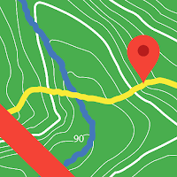


Table of contents
Latest updates
What's new in BackCountry Nav Topo Maps GPS 7.1.6
-Address issues starting app on 4.x
-File browsing fixes still in progress Mostly affecting GPX import/export and Prebuilt map on Android 11
Paid Addons available with the PRO version include AccuTerra map source,Thunderforest Map Source, BLM Boundary Maps, and GMU boundaries.
Editor's review
Download the latest BackCountry Nav Topo Maps GPS application, version 7.1.6, compatible with Windows 10/11 (using emulators such as Bluestacks), Android devices. This free Maps & Navigation app is developed by CritterMap Software LLC and is easy to download and install.
Previous versions, including 7.1.6, are also available. If you need help or have any problems, please let us know.
Description
Use offline topo maps and GPS on hike trails without cell service! The GPS in your Android phone can get its position from satellites, and you don’t have to rely on your data plan to get maps. Have more fun and safe GPS adventures in the backcountry.
Preload FREE offline topo maps, aerial photos, and road maps on your storage memory, so they are ready when you need them.
Add custom GPS waypoints in longitude and latitude, UTM or MGRS grid reference. Import GPS waypoints from GPX files. Choose icons for waypoints much like in MapSource. (This app uses the WGS84 datum, NAD27 is available in settings).
Use GPS for hunting a waypoint or geocache, for recording tracks and GPS waypoints on your trip, all the while tracking your quest on topographic maps.
About topo (topographic) maps: Topo maps show terrain through color and contours, and are useful for navigation offroad. Topo maps and GPS can be used for hiking, hunting, kayaking, snowshoeing, & backpacker trails.
The app has many built in map sources and allows you to create your own maps with Mobile Atlas Creator. Built in sources include:
OpenStreetMaps and NASA landsat data worldwide.
OpenCyle Maps are topo maps that show terrain worldwide.
USGS Color Aerial photography.
Topographic Maps of Spain and Italy.
Outdoor maps of Germany and Austria
Topo maps of New Zealand
Here are some of the outdoor GPS activities BackCountry Navigator has been used for:
Hiking both on hiking trails and off trail.
Camping, to find the perfect camping site or the way back to camp.
Hunting trips for hunting wild game in rugged areas, including recon for the hunt.
Bait fishing or fly fishing with a buddy.
Search and Rescue (SAR) with GPS.
Kayak and canoe trips on inland lakes and streams or marine, coastal waters.
Backpacker trips: using topo maps of wilderness areas and national forests to navigate on trails with the GPS.
Snow adventures including snowmobiling, skiing (alpine or cross country) and snowshoeing. Create a memory. Map it out.
This a great addition to the outdoor gear you bought at Cabelas, REI, or another outdoor store. Your android phone could substitute for a Garmin or Magellan outdoor handheld GPS! You storage has memory for maps.
Find your own ways to have fun in the outdoors. Be a maverick by venturing into new territory beyond cell service boundaries. Become a pro at navigation with GPS.
BackCountry Navigator has been previously available on WM devices and preloaded on the Trimble Nomad outdoor rugged device. This Android version is more flexible, featured, and fun.
App permissions
BackCountry Nav Topo Maps GPS 7.1.6 APK requires following permissions:
Allows an application to write to external storage.
Allows an application to read from external storage.
Allows applications to open network sockets.
Allows an app to access approximate location.
Allows an app to access precise location.
Allows applications to access information about networks.
Allows applications to change Wi-Fi connectivity state.
Allows an application to access extra location provider commands.
Allows an application to record audio.
Required to be able to access the camera device.
Allows applications to connect to paired bluetooth devices.
Allows applications to discover and pair bluetooth devices.
Allows applications to access information about Wi-Fi networks.
Allows using PowerManager WakeLocks to keep processor from sleeping or screen from dimming.
Allows an application to receive the ACTION_BOOT_COMPLETED that is broadcast after the system finishes booting.
Ratings and Reviews
Rating: 3.8/5 based on 5K+ reviews
(*) is required
4 ★ Generaly useful. One issue I have is simple functions like goto or measure distances are buried and difficult to find. It would seem logical to have basic functions available from the home screen or main menu page. Another issue I have is the names of waypoints are in a small black font and difficult to read on a dark map. It would be useful to be able to change the font color.
2 ★ .... update... the recent version made this worse. now, force stop doesn't even close it. Previously workable, now completely unusable. I have to delete as my battery will die within half a day. ... great app. a little buggy on closing though. Even when closed, the app continues in the background. I need to"force stop" each time i close or it drains my battery heavily. maybe an update can address this?
1 ★ Just uninstalled it, as last update would no allow easy opting-out from location tracking for advertising purposes. There are better, less invasive apps out there, bye bye Navigator. Good UK map, useless for tracks. UK is covered with the excellent OS Explorer maps. However I seldom can use it for anything else: maps for rest of the world are not that good, and cannot open downloaded tracks (perhaps a recent update, or incompatibility with my phone? A Pro-only feature?)
5 ★ Fantastic app!!! Easy to use, reliable, cross-compatible, and full featured without forcing you to buy needlless subscriptions and maps. It is an indispensable tool in planning and hiking any trip of any length. We have used this on nearly 50 trips in 4 years. Its coming on our SOBO thru-hike of the AT this year. The demo is completely capable, but this deserves support for the developers. As a software developer, thank you for the great work you do.
5 ★ I can't sing enough praises of this app. It does everything any outdoor GPS unit ever did, runs in out of coverage areas, and has the most extensive set of worldwide hiking maps I've seen. This last perk is really special: in many countries around the world there simply aren't good maps available for outdoor enthusiasts, but Backcountry Navigator has them all! I never review anything but for this app I am making an exception. I would give it 6 stars, or even 7 if it was possible.
4 ★ Used the demo version for a good 3+years and just kept meaning to upgrade. Sale offer so finally did! Use this constantly for MTBing & walking etc. Super useful. Love offline maps. Only rated 4 because menus are difficult to use: symbols not words so need to memorise functions, which I find tough. Functionality terrific though.
5 ★ Great app for backcountry navigation and tracking. I've been using this for years. Now I use the subscription service and it's even better. I have downloaded maps of huge areas. You can either let the app do its thing or be a power user to take full advantage of all it has. I don't go outdoors without this app.
4 ★ I got the pro version when it went on sale. I like this one over Gaia because it is easier to import .gpx files and overlay them on a map. I also like the layer options better than Gaia. Offline maps and zoom levels can be finicky.
5 ★ The best app for cross country navigation in Europe and US I found and tested. And I tried quite a number. Accurate, low energy use, easy to use once you learned basic fuctions. The demo is wholly functional with all important features intact which is rare. Upgraded to paid version as a way of saying thanks to the developers.
5 ★ Great navigation app. Very usable free version. Different maps for cycling and walking. Some maps have all trails. The only app that comes close to paper. Finally bought it after great usage for 180 days to support the developers and get rid of the "This is a demo" pop up
5 ★ Amazing app, buy the pro it is totally worth it. We've been using it to survey trail systems for a year and it works exactly as advertised. Its stable and reliable, but a few rough usability edges. Overall it's the best out there.
5 ★ I use this app for hunting and side-by-side rides and walking my dog and this is the most comprehensive app I have found yet even the demo version. There are so many things you can do with this app it's amazing. I use this app with the upmost confidence even offline with no data usage.
5 ★ Excellent app, having access to full OS UK maps is great. I use the application for walking as well as geocaching and it is always accurate and has never given me any problems. I highly recommend that you upgrade to the full version.
2 ★ Why is the disable tracking analytics option greyed out?
4 ★ I just wanted a hiking gps that I could use offline, import/export gpx files, didn't have all the extra social fluff, and did not require a subscription. After looking at several other apps and being disappointed, this seems to fit the bill nicely.
Previous versions
BackCountry Nav Topo Maps GPS 7.1.6 APK for Windows (#716, 16.7 MB)
Similar to BackCountry Nav Topo Maps GPS
More from CritterMap Software LLC
Mini Sudoku 9X9- Genius 24/7 APK
Brain Audio: Sleep Relax Focus APK
Integral Scientific Calculator APK
Blue Carbon Analog Watch Face APK
BackCountry Navigator XE: Topo APK
Adventure Analog Watch Face APK
Divers Watch Face for Wear APK
Top download apps
فیلتر شکن جدید و قوی،فیلتر شکن قوی و پرسرعت رایگان APK