Sweden Topo Maps APK
App information
Version 7.5.1 (#381)
Updated 2024-12-22
APK Size 40 MB
Requires Android Android 7.0+ (Nougat)
Offered by ATLOGIS Geoinformatics GmbH & Co. KG
Category Free Maps & Navigation App
App id com.atlogis.sweden
Developer's notes Outdoor GPS Navigation with the best maps and aerial imagery for Sweden.
Screenshot
Click on the image to see full size
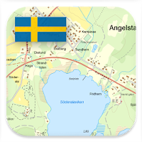


Table of contents
Latest updates
What's new in Sweden Topo Maps 7.5.1
Editor's review
Download the latest Sweden Topo Maps application, version 7.5.1, compatible with Windows 10/11 (using emulators such as Bluestacks), Android devices. This free Maps & Navigation app is developed by ATLOGIS Geoinformatics GmbH & Co. KG and is easy to download and install.
Previous versions, including 7.5.1, 7.4.1, 7.4.0, 7.2.2, 7.1.0, are also available. If you need help or have any problems, please let us know.
Description
++ For offline use PRO features needed ! ++
Turn your Andoid Phone/Tablet into an outdoor GPS for trips into the backcountry WITHOUT CELL COVERAGE. This app gives you similar mapping options as you might know from Garmin or Magellan GPS handhelds.
Included FREE map layers:
• Topographic Map 1:50.000 for Scandinavia ( Denmark, Norway, Sweden und Finland) with hillshading. Lantmateriet Terrängkartan + Fjällkartan
• Topowebb Lantmateriet Topographic Map for Sweden
• OpenStreetMaps : These crowdsourced maps are a very useful addition to other map layers. Contains many unique features.
• OpenCycleMaps: These maps are ideal to plan bicycle trips (PRO Users only !)
• ESRI Topographic
• ESRI Aerial Images
• ESRI Street Map
• Google Road Map (online access only)
• Google Satellite Images (online access only)
• Google Terrain Map (online access only)
• Bing Road Map (online access only)
• Bing Satellite Images (online access only)
• Earth At Night
• Hillshading overlay
Main features for outdoor-navigation:
• Create and edit Waypoints
• GoTo-Waypoint-Navigation
• Track Recording (with speed, elevation and accuracy profile)
• Tripmaster with fields for odometer, average speed, bearing, elevation, etc.
• GPX/KML/KMZ Export
• Search (placenames, POIs, streets)
• Customizable datafields in Map View and Tripmaster (e.g. Speed, Distance, Compass, ...)
• Share Waypoints, Tracks or Routes (via eMail, Whatsapp, Dropbox, Facebook, ..)
• Display coordinates in Lat/Lon, UTM or MGRS/USNG (Military Grid/ US National Grid)
• Record & share tracks with statistics & elevation profile
• Rotate map (Track Up & North Up)
• Get Elevation and Distance by long click on map
• Track Replay
• Add custom map tile servers
• and many more ...
Available Pro features: (Pro features available via In App Purchase)
• Offline Use - no cell coverage needed. No Roaming fees !
• Easy+Fast Bulk-download of map tiles for OFFLINE USAGE (not for Google and Bing maps)
• Create and edit Routes
• Route-Navigation (Point-to-Point Navigation)
• GPX/KML/KMZ Import/Export
• unlimited Waypoints & Tracks
• Add other Map Tile-Server
• No Ads
Offline Use:
All viewed map tiles are kept in cache. To cache large areas you need to purchase Pro features.
Use this navigation app for outdoor activities like hiking, biking, camping, climbing, riding, skiing, canoeing, hunting, offroad 4WD tours or search&rescue (SAR).
Add custom waypoints in longitude/latitude, UTM or MGRS/USNG format with WGS84 datum.
Import/Export/Share GPS-Waypoints/Tracks/Routes in GPX or Google Earth KML/KMZ format.
Preload FREE map data for areas without cell service (Pro feature !).
Comments and feature requests to swedenmaps@atlogis.com
Have a look at our other outdoor navigation apps: https://play.google.com/store/search?q=atlogis
+++ We DO NOT track any user activities or collect any user data ! +++
App permissions
Sweden Topo Maps 7.5.1 APK requires following permissions:
Allows an app to access precise location.
Permission an application must hold in order to use ACTION_REQUEST_IGNORE_BATTERY_OPTIMIZATIONS.
Allows applications to access information about networks.
Allows applications to open network sockets.
Allows using PowerManager WakeLocks to keep processor from sleeping or screen from dimming.
Allows access to the vibrator.
Allows an application to read from external storage.
Allows an application to write to external storage.
Ratings and Reviews
Rating: 4.4/5 based on 3K+ reviews
(*) is required
2 ★ I like it. In fact I liked so much that I decided to spend the money, 129 SEK, to buy the app. However, after spending my money and downloaded a couple of maps it refuses to show any map. What can I do? Is there a way to reset everything? Seems to be unable to find my location. Anything I can do myself to fix this? Any suggestion please! As of now it is useless to me! Answer to questions: Yes! Three issues, one resolved, two remain. "Battery optimization" - resolved "System Time" and "ATLOGIS Server Connection" NOT resolved. Thanks for the very quick response! Can't find how to contact support directly.
1 ★ The map of Sweden just doesn't download for offline use. I've tried many tine with and without Wi-Fi and it just doesn't work. Other countries weren't a problem by the one I actually need doesn't work. I've purchase the extended version and I'm quite disappointed, as I really don't know what the problem is.
5 ★ This app has beautiful hiking maps of Sweden, good OSM maps of the rest of europe too, and even dedicated water and cycling maps. Works well, not too complicated. Satisfied user of the pro version for years already.
2 ★ While a pretty good map app with an array of layers available, it fails at the tasks of route tracking and similar - when starting to record my route, it says "waiting for GPS" (even though it had contact before I tapped record) and judging by the results it did not record anything at all
5 ★ Very detailed and informative map. It shows all the locations of serviced and non-serviced cabins in the fjäll. It shows also the less trodden trails. Many thanks to the mapmakers!
5 ★ very good, especially in open air, but it needs contact with the sky/gps to function properly, obviously
1 ★ The topo map is very fuzzy when zoomed in. Free alternatives are not. Crashes when many POIs are loaded. Loses POIs constantly. Disappointed with this app.
4 ★ Very good and usefull. Only thing that annoy me is that the map rotates too easy, whenever I zoom in or out.
5 ★ Stable and good. I use it when walkingand running in new areas and cities
4 ★ Great app, I use it to navigate on gravel roads.
5 ★ This is one of the best map applications ever.
1 ★ Ads playing loud. Uninstall.
4 ★ Does the job. Nice to have terrain maps where I go in Sweden.
5 ★ Good quality maps! (fjällkartan)
5 ★ Great nav app!
Previous versions
Sweden Topo Maps 7.5.1 APK for Windows (#381, 40 MB)
Sweden Topo Maps 7.4.1 APK for Windows (#355, 18.9 MB)
Sweden Topo Maps 7.4.0 APK for Windows (#352, 35.6 MB)
Similar to Sweden Topo Maps
More from ATLOGIS Geoinformatics GmbH & Co. KG
Top download apps
Resso Music - Songs & Lyrics APK