New Zealand Topo Maps Pro APK
App information
Version 5.1.3 (#1)
Updated 2018-08-16
APK Size 1 MB
Requires Android Android 2.3+ (Gingerbread)
Offered by ATLOGIS Geoinformatics GmbH & Co. KG
Category Free Maps & Navigation App
App id com.atlogis.nzmaps
Developer's notes NZ Topographic Maps, Nautical Charts and Aerial Imagery - works Offline !
Screenshot
Click on the image to see full size


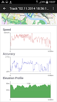


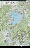
Table of contents
Latest updates
What's new in New Zealand Topo Maps Pro 5.1.3
Editor's review
Download the latest New Zealand Topo Maps Pro application, version 5.1.3, compatible with Windows 10/11 (using emulators such as Bluestacks), Android devices. This free Maps & Navigation app is developed by ATLOGIS Geoinformatics GmbH & Co. KG and is easy to download and install.
Previous versions, including 5.1.3, are also available. If you need help or have any problems, please let us know.
Description
This app gives you similar mapping options as you might know from Garmin or Magellan GPS handhelds.
*** Updated Topo50 maps to 2017 Edition ! ***
Main features for outdoor-navigation:
• Bulk-download of map tiles for OFFLINE USAGE (not for Google and Bing maps)
• Create and edit Waypoints
• GoTo-Waypoint-Navigation
• Create and edit Routes
• Route-Navigation (Point-to-Point Navigation)
• Track Recording (with speed, elevation and accuracy profile)
• Tripmaster with fields for odometer, average speed, bearing, elevation, etc.
• GPX-Import / Export, KML-Export
• Search (placenames, POIs, streets)
• Customizable datafields in Map View and Tripmaster (e.g. Speed, Distance, Compass, ...)
• Share Waypoints, Tracks or Routes (via eMail, Facebook, ..)
• Use Coordinates in UTM, WGS84 or MGRS
• and many more ...
Overlay layers:
• Public Conservation Areas
• Open Hunting Areas
• DOC Camp Sites
• DOC Freedom Camping Restrictions
• DOC Huts
• DOC TRacks
• Taupo Trout Fishing District
• Hillshading
Use this navigation app for outdoor activities like hiking, biking, camping, climbing, riding, skiing, canoeing or offroad 4WD tours.
Preload FREE map data for areas without cell service.
The topographic maps were created by Land Information New Zealand (LINZ).
Topo50 is the official topographic map series used by New Zealand emergency services.
How topographic information is used
Defence planning: New Zealand's defence forces use topographic information for planning military exercises and swapping information with international partners.
Location and routing: Search and Rescue, defence, ambulance, fire service, police and civil defence agencies use topographic information in a wide range of planning and operational situations, from natural disasters to community policing. Usage may involve mobile/field and control room situations, and the combination of topographic information with other data.
Land management: Topographic information is used by local government for regional planning and operations, and by power, gas and telecommunications companies.
In addition, LINZ maps are used for a great variety of purposes by businesses and government departments such as the Department of Conservation, and by recreational users such as trampers and tourists.
All topographic maps have additional labels for better readability at higher zoom scales. Maps are rendered with Atlogis® hillshading to enhance topography.
Topo Map Coverage:
New Zealand and Islands (Antipodes, Auckland, Bounty, Campbell, Chatham, Kermadec, Raoul, Snares and Stewart Islands) at scale 1:50.000 and 1:250.000
Cook Islands (Aitutaki, Atiu, Mangaia, Manihiki, Mauke, Mitiaro, Palmerston, Penrhyn, Pukapuka, Rakahanga, Rarotonga, Suwarrow, Takute) at scale 1:25.000
Tokelau Islands (Atafu, Nukunonu, Fakaofo) at scale 1:25.000
Please send comments and feature requests to nzmaps@atlogis.com
Ratings and Reviews
Rating: 4.4/5 based on 4+ reviews
(*) is required
5 ★ Just starting to use it and looking good so far.
5 ★ Awesome app. Very intuitive to use and an indispensable tool for planning hunting trips/wilderness excursions in NZ.
4 ★ How to get updated new zealand maps?. Some I've cached are old.
5 ★ Love it but could do with a few improvements.
5 ★ very useful
4 ★ Great for Outdoors
5 ★ Cool
5 ★ I found this app to be very helpful when lost in Sydney. Haven't used it in the bush yet, so it will be very interesting to see, if it will help me find my way out.
4 ★ Great for the outdoors once you have cached the maps
4 ★ nice to have NZ topo maps underlying the GPS tracking; certainly makes route planning and navigation a lot easier.
5 ★ Superb App that I have been using for the last couple of years. Great being able to cache Topo Maps and aerial photos. Has saved my bacon a couple of times. Big thumbs up to the developers!
5 ★ Love it. Has topo, charts and satillite photos. I preload the tiles I need and it caches a whole lot more. Good tracks, good Goto, good current position.
4 ★ a solid 5 stars would love to see vessel AIS intergration would be ultimate marine app.great work.
5 ★ Exellent shame we can't use more of it offline
5 ★ This is awesome in the bush .. so long as you have battery power you are never completely lost.
Previous versions
Similar to New Zealand Topo Maps Pro
More from ATLOGIS Geoinformatics GmbH & Co. KG
Top download apps
Resso Music - Songs & Lyrics APK