US Topo Maps APK
App information
Version 7.6.0 (#384)
Updated 2025-01-23
APK Size 128.8 MB
Requires Android Android 7.0+ (Nougat)
Offered by ATLOGIS Geoinformatics GmbH & Co. KG
Category Free Maps & Navigation App
App id com.atlogis.northamerica.free
Developer's notes Offroad & Outdoor Navigation. Multiple Maps: Topo, Aerials, Nautical Charts, etc
Screenshot
Click on the image to see full size
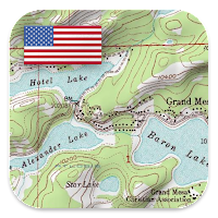


Table of contents
Latest updates
What's new in US Topo Maps 7.6.0
・New layer 'Mexico 20k & 50k & 250k'
・Layer 'Traditional Topos' now also covers Canada
・Improvements & Fixes
Editor's review
Download the latest US Topo Maps application, version 7.6.0, compatible with Windows 10/11 (using emulators such as Bluestacks), Android devices. This free Maps & Navigation app is developed by ATLOGIS Geoinformatics GmbH & Co. KG and is easy to download and install.
Previous versions, including 7.6.0, 7.5.0, 7.5.0, 7.4.0, 7.2.3, 7.2.2, are also available. If you need help or have any problems, please let us know.
Description
Choose between 30+ map layers (topos, aerials, sea charts, ...) to plan the perfect trip and
turn your Andoid Phone/Tablet into an outdoor GPS for offline trips into the backcountry.
Add easily maps from other sources (GeoPDF, GeoTiff, Online Map Services like WMS, ...)
Available basemap layers for USA:
• USGS National Map Topo
• USGS National Map Imagery Topo
• USGS National Map Imagery
• USGS NAIP HiRes Imagery
• USGS Topo traditional DRGs: Seamless coverage of topo maps of the USA at Scales 1:250.000, 1:100.000, 1:63.000 and 1:24.000/25.000
• FSTopo Forest Maps
• NOAA Nautical RNC Charts
• National Elevation Maps (Hillshade, Slope Map, Aspect Map)
Worldwide basemap layers:
• OpenStreetMaps (5 different map layouts), also downloadable in space saving vectorformat
• Google Maps (Satellite images, Road- and Terrain-Map)
• Bing Maps (Satellite images, Road-Map)
• ESRI Maps (Satellite images, Road- and Terrain-Map)
• Earth At Night
Configure a basemap layer as an overlay and utilize a transparency fader to seamlessly compare maps with each other.
Add maps from other sources:
• Import raster maps in GeoPDF, GeoTiff, MBTiles or Ozi (Oziexplorer OZF2 & OZF3)
• Add web mapping services as WMS or WMTS/Tileserver
• Import OpenStreetMaps in Vectorformat, eg complete USA for just some GBs
Available US map Overlays - add additional information to any other base map:
• Public Land Ownership (PAD-US 3)
• National Hydrographic Dataset
• Motor Vehicle Use Map (USDA)
• Elevation Contourlines
• 4WD Trails
• Trails
• Roads, Railroads, Airports
Available worldwide overlays:
• Hillshading overlay
• 20m Contourlines
• OpenSeaMap
There is no perfect map. Toggle between the different map layers or use the compare maps feature to find the most interesting route. Especially the old traditional DRGs contain many small pathes or other features that are missing on modern maps.
Main features for outdoor-navigation:
• Download map data for OFFLINE USAGE
• Measure pathes and aereas
• Create and edit Waypoints
• GoTo-Waypoint-Navigation
• Create and edit Routes
• Route-Navigation (Point-to-Point Navigation)
• Track Recording (with speed, elevation and accuracy profile)
• Tripmaster with fields for odometer, average speed, bearing, elevation, etc.
• GPX/KML/KMZ Import/Export
• Search (placenames, POIs, streets)
• Get elevation and distance
• Customizable datafields in Map View and Tripmaster (e.g. Speed, Distance, Compass, ...)
• Share Waypoints, Tracks or Routes (via eMail, Dropbox, WhatsApp, ..)
• Use coordinates in WGS84, UTM or MGRS/USNG (Military Grid/ US National Grid), What3Words• Track Replay
• and many more ...
Use this navigation app for outdoor activities like hiking, biking, camping, climbing, riding, skiing, canoeing, hunting, snowmobile tours, offroad 4WD tours or search&rescue (SAR).
Add custom waypoints in longitude/latitude, UTM or MGRS/USNG format with WGS84 datum.
Import/Export/Share GPS-Waypoints/Tracks/Routes in GPX or Google Earth KML/KMZ format.
See animated NEXRAD rain radar to make accurate predictions when raining will start/stop
Please send questions, comments and feature requests to support@atlogis.com
App permissions
US Topo Maps 7.6.0 APK requires following permissions:
Allows an app to access precise location.
Permission an application must hold in order to use ACTION_REQUEST_IGNORE_BATTERY_OPTIMIZATIONS.
Allows applications to access information about networks.
Allows applications to open network sockets.
Allows using PowerManager WakeLocks to keep processor from sleeping or screen from dimming.
Allows access to the vibrator.
Allows an application to read from external storage.
Allows an application to write to external storage.
Ratings and Reviews
Rating: 4.6/5 based on 10K+ reviews
(*) is required
4 ★ This is a fantastically useful app. It's generally easy to use, reliable, and provides a wide selection of base layers and overlays. Route tracking is accurate, and even while active, isn't too bad a drain on battery life. I still carry a backup paper map in more remote areas, but I'm very comfortable using this app as a primary. Really I'd like to give this app 4.5, not 4 stars, the half-star for the confusing process of importing data from external sources. That said, it's worth every penny.
4 ★ I'm still really new to navigating the wilds, but this app is easy to understand with the experience I do have. I was able to navigate a brand new trail I found using this. Definitely worthwhile to have. Still, its more of just a map than anything, I couldn't remember what direction I was going in so I had to turn back at a certain point. Wouldn't hurt to carry a real compass with you when using this.
4 ★ One big problem This is an excellent app for displaying a wide variety of different maps. One serious negative is that it won't let me zoom in enough to read the labels. I can momentarily pinch zoom in, but as soon as I let go it snaps back out so i can't read it again. Why? Seems like an arbitrary restriction that greatly reduces the usefulness of the program.
1 ★ Overall, not bad. But, if you want to download a detailed area of your state for when you have no cell signal - good luck! I've been trying to download a segment of my state for five days! First, there is no "resume" if the download stops. There is "restart" and the app tries to download everything again. It validates some tiles - but, the validation takes so long that my phone will pause so to inactivity before it finishes validating! I can never get more than 75% of level 16.
5 ★ Unbelievable map resource...and im only using the free app. Will definetly buy the pro version when i get a new phone. In free you get crazy maps, overlays, weather, etc plus route tracking, so many GPS functions as well. If you spend time in the woods and want more than google/apple maps for camping, hunting/fishing, trail work, hiking etc, then you need this.
5 ★ This app must've been updated, since the 1st time I tried to use it, it told me I didn't have enough memory, but now, that's no longer an issue, & it loads & works quite well. (If I wasn't physically disabled, I'd be using it a lot more, even with the presently insane fuel costs.) (If I can ever get my spine rebuilt properly, or find a way around the disability, I'd be a "full-time" RV'er, & have this app in the "spare" phone I keep on my dashboard.) Good job on the updating!
5 ★ I have the professional version (upgrade from free). This is a really easy map application but it is meant for people who understand maps and specifically USGS topo maps. It also appears that the maps used are relatively (remember these are old maps) up to date. So if you want good outdoor maps and basic GPS functionality (waypoints, tracks, positioning) - this is the best. What it does lack is collaborative features that some of the services offer (at a much higher cost) - such as recent GPSs trails and information about those trails (trailheads, features, shared waypoints, etc...) The newer off-line map feature has proven tremendously useful as many locations have nearly zero coverage. Recommendation: Install this, if you like it and use it - upgrade to pro for more extensive features.
5 ★ By far the very best topo map app I have ever used, and that isnt even the tip of the iceberg as far as how versatile and incredibly useful this app can be. In so many different ways. A total hidden gem for hiking and wilderness navigation, (or waterways) for hiking or work, etc; this is the only app you will need for navigation or travel. I never even leave reviews, but this is that good of an app, its now a crucial tool ill be using for all my hikes, huge appreciation for the makers of this.
1 ★ To much missing data to be really useful. It's amateurish at best. I used US topo maps on the computer 20+ yrs ago and it had all the data then. Effectively they reproduced a full 7.5" topo, it was great. For old timers who can read terrain, use a compass and orient themselves with a stick and the sun maybe this modern stuff is too hard or too silly.
4 ★ Excellent selection of a wide variety of maps. I personally learned to analyze terrain and navigate in the military using topographic maps. A satellite view is barely sufficient to see what the ground actually looks like, especially if it hidden by tree cover This app can help select a quality map to get a far better idea of the terrain than you will get just using Google.
2 ★ This would be a great tool, except you need cell service for it to work! Unlike Google maps and other good map apps, you can't pre-download a map of the area you're going to so that it'll be stored for when you lose cell service. I had my location's map pulled up on my screen, but once I lost cell service it disappeared and was useless.
1 ★ Whoever's rating this app at 4 or 5 stars has never been off the paved road or been out of cell service. Even if you get a map cached, its difficult to use, you can't zoom past a certain point, can't use the normal tools and is super slow. I sent my an inquiry for assistance but never heard back from the publisher. I would like my money back.
4 ★ I would prefer actual grid lines to the dots, in the UTM overlay, so a choice would be nice, but in either case, the grid lines need to be constantly identified (by two digit number), and the area covered by the map displayed in the margin. A "pop-up" box, displaying both UTM grid, and Lat/Long of a point would be useful also, for search, rescue, and recovery.
1 ★ Missing most of the Forest mainline roads, spurs, etc. (numbers and names) in Capitol State Forest (Black Hills), Washington State. Uninstalling this map. Horrible land navigation tool. Names are wrong, roads and trails aren't properly shown and natural landmarks aren't listed. Waste of time to dload. I'll use my paper maps I have. Older but far more accurate than this "guide".
5 ★ This app is amazing ! Seriously ! I cant beleive its free !! You can neatly save waypoints, save, share, huge database of detailed maps which you can choose at your leisure ! Send long. and lat. in 3 different formats. even has links directly to google maps! FREE ! I went through roughly 10 apps before I found this one. I need lon. and lat pinpoint cordinents and a topo map to plan out hikes. this app is the best. Ive only seen one add so far Im sure their in here, but honestly I dont care.
Previous versions
US Topo Maps 7.6.0 APK for Windows (#384, 128.8 MB)
US Topo Maps 7.5.0 APK for Windows (#379, 150.3 MB)
US Topo Maps 7.5.0 APK for Windows (#369, 144.8 MB)
US Topo Maps 7.4.0 APK for Windows (#352, 124.9 MB)
Similar to US Topo Maps
More from ATLOGIS Geoinformatics GmbH & Co. KG
Top download apps
Resso Music - Songs & Lyrics APK