US Topo Maps Pro APK
App information
Version 5.1.3 (#1)
Updated 2021-06-15
APK Size 1 MB
Requires Android Android 2.3+ (Gingerbread)
Offered by ATLOGIS Geoinformatics GmbH & Co. KG
Category Free Maps & Navigation App
App id com.atlogis.northamerica
Developer's notes Outdoor & Offroad Navigation - Store Maps for Offline Usage
Screenshot
Click on the image to see full size
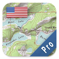


Table of contents
Latest updates
What's new in US Topo Maps Pro 5.1.3
• Bottom sheets for Markers, Waypoints & Searchresults
• New wizard to add tiled online layers
• Improvements & Fixes
Editor's review
Download the latest US Topo Maps Pro application, version 5.1.3, compatible with Windows 10/11 (using emulators such as Bluestacks), Android devices. This free Maps & Navigation app is developed by ATLOGIS Geoinformatics GmbH & Co. KG and is easy to download and install.
Previous versions, including 5.1.3, are also available. If you need help or have any problems, please let us know.
Description
Choose between >20 map layers (topos, aerials, sea charts, flight maps, ...)
Turn your Andoid Phone/Tablet into an outdoor GPS for trips into the backcountry without cell coverage. This app gives you similar mapping options as you might know from GPS handhelds.
Premium email support - we'll answer your questions within 24 hours
Main features for outdoor-navigation:
• Download of map tiles for OFFLINE USAGE (not for Google and Bing maps)
• Display Real-Time nowCoast Weather Information and NEXRAD Weather Radar (animated)
• Free access to more than 100.000 seamlessly stitched USGS topographic maps - easy to use as browsable map layer
• Create and edit Waypoints
• GoTo-Waypoint-Navigation
• Create and edit Routes
• Route-Navigation (Point-to-Point Navigation)
• Track Recording (with speed, elevation and accuracy profile)
• Tripmaster with fields for odometer, average speed, bearing, elevation, etc.
• GPX/KML/KMZ Import/Export
• Search (placenames, POIs, streets)
• Customizable datafields in Map View and Tripmaster (e.g. Speed, Distance, Compass, ...)
• Share Waypoints, Tracks or Routes (via eMail, Dropbox, Facebook, ..)
• Use coordinates in WGS84, UTM or MGRS/USNG (Military Grid/ US National Grid)
• Get NWS Weather Forecast
• Track Replay
• and many more ...
Available map layers:
• USGS DRGs: Seamless coverage of topo maps of the USA at Scales 1:250.000, 1:100.000, 1:63.000 and 1:24.000/25.000
• New US Topo maps
• USGS High Resolution aerial imagery
• USGS National Map
• NAIP Orthoimagery for conterminous US
• Google Maps (Satellite images, Road- and Terrain-Map)
• Bing Maps
• Open Street Maps
• FSTopo Forest Maps
• NOAA Nautical RNC Charts
• Flight Maps
• Public Land Ownership (Padus)
• Earth At Night
Available map overlays:
• Hillshading
• Ridge Weather Radar NWS
• Wind, Temperature, Pressure
• Wind Vectors
• Precipitation Estimate - 1-hr
• Precipitation Forecast 24h
• Surface Air Temperature
• Hazard Warnings
• Tropical Cyclone Track
• Wind Vector Forecast 24h
• Max. Air Forecast 24h
• Min. Air Forecast 24h
USGS DRG topographic maps:
The 7.5-minute maps (1:24.000/1:25.000) are the best maps for outdoor activities in the USA. Although some of the maps are quite old, they contain many small pathes and 4WD tracks that are missing in new USTopos, Google, Bing and OSM maps.
DRGs (Digital Raster Graphics) were produced from 1995 to 2001 by U.S. Geological Survey. DRGs have been made for all quadrangles in the USGS map series.
New US Topo Maps:
US Topo maps are a graphic synthesis of The National Map data files and are produced in the familiar 7.5-minute by 7.5- minute geographic format. Current US Topo map layers include an orthoimage base, transportation, geographic names, topographic contours, boundaries, hydrography and woodlands. Also included are the Public Land Survey System (PLSS) and the United States National Grid.
NAIP Orthoimagery:
Seamless coverage of contiguous US with 1m/pixel resolution
HRO aerial imagery:
High resolution arial photos covering US urban areas and borders (up to 10cm/pixel)
Use this navigation app for outdoor activities like hiking, biking, camping, climbing, riding, skiing, canoeing, hunting, offroad 4WD tours or search&rescue (SAR).
Import/Export/Share GPS-Waypoints/Tracks/Routes in GPX or Google Earth KML/KMZ format.
View Real-time nowCoast weather information like temperature or windvectors and overlay to map.
See animated NEXRAD rain radar to make accurate predictions when raining will start/stop.
Preload FREE map data for areas without cell service.
US topographic maps are enhanced with Atlogis® hillshading and placenames.
Free version available.
Comments and feature requests to usmaps@atlogis.com
Ratings and Reviews
Rating: 4.7/5 based on 2K+ reviews
(*) is required
5 ★ I use this almost everyday to keep track of how far I hike. I have been using for at least the last 2 years and love it. Absolutly no problems! Works in the car too!
5 ★ I use this app all the time while hiking. Works great for tracking distance and elevation changes, as well as general orientation.
5 ★ The wide scope or even the sheer quantity of maps available almost boggles the mind. Combine this with light resource usage & smooth responsiveness and you have an app worthy of high praise. I highly recommend it.
5 ★ Downloaded 3 sets of maps that cover the entire area in which I'm interested. Took some time but now, if I don't have internet available, I still have the maps. Works just like I expected.
4 ★ Improved over last few years it is my ho to hiking map/track app. Still have so problems with cached maps that don't always display at the full depth as downloaded.
5 ★ Download the map area before the trip, this tool has been priceless, i have used it in places where there are no trails and across mountains, i've used it on the coastal plain to the piedmont to the mountains.
5 ★ This app has everything I need to download maps, tracks and waypoints for offline backcountry adventures. Doesn't run down phone battery either.
2 ★ The free version is much better! The pro doesn't give access to different and/or useful topographical maps, and the pro version doesn't load every map anyway!
5 ★ I am very pleased and happy with this U.S. TOPO MAPS PRO App. It works GREAT all the time when out on the jeep trail or on a ATV trail now when you take off on a walk to no where you'll now know where no where is with this App ,The BEST GPS and compass in one great App, Real time tracking is a must when you are hiking the mounting trails or city streets of the world, (it isn't a car GPS will not work as such),
4 ★ This is my go-to app when USGS topos are the best map source. Not good for navigation routes. Easy transfer of tracks to my computer mapping software.
5 ★ Everything you need for land navigation! Routes, waypoints, offline maps, and lots more.
4 ★ Works great as long as you remember to download maps of the area ahead of the trip. Crashes often when downloading large areas at max zoom level, but eventually works. Very reliable once map downloaded, done remote backpacking trips with phone on airplane mode and location on.
1 ★ This app doesn't work. All the areas I try to look up are blanked out. Useless I want my money back.
4 ★ Great app. Would give a 5 but the Track Up feature does not work. North is always up no mayter the setting
5 ★ Great maps measuring feature easy to use. Love this map app. Had minor questions and developer answered promptly
Previous versions
Similar to US Topo Maps Pro
More from ATLOGIS Geoinformatics GmbH & Co. KG
Top download apps
Resso Music - Songs & Lyrics APK