Denmark Topo Maps APK
App information
Version 7.5.1 (#382)
Updated 2024-12-22
APK Size 38 MB
Requires Android Android 7.0+ (Nougat)
Offered by ATLOGIS Geoinformatics GmbH & Co. KG
Category Free Maps & Navigation App
App id com.atlogis.denmark
Developer's notes Outdoor GPS Navigation with the best maps and aerial imagery for Denmark.
Screenshot
Click on the image to see full size
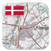


Table of contents
Latest updates
What's new in Denmark Topo Maps 7.5.1
Editor's review
Download the latest Denmark Topo Maps application, version 7.5.1, compatible with Windows 10/11 (using emulators such as Bluestacks), Android devices. This free Maps & Navigation app is developed by ATLOGIS Geoinformatics GmbH & Co. KG and is easy to download and install.
Previous versions, including 7.5.1, 7.4.1, 7.4.0, are also available. If you need help or have any problems, please let us know.
Description
Easy to use Outdoor/Offline GPS navigation app with access to the best topographic maps and satellite images for Denmark.
++ For offline use PRO features needed ! ++
Turn your Andoid Phone/Tablet into an outdoor GPS for trips into the backcountry WITHOUT CELL COVERAGE. This app gives you similar mapping options as you might know from Garmin or Magellan GPS handhelds.
Included FREE map layers:
• Topographic Map 1:50.000 for Scandinavia ( Denmark, Norway, Sweden und Finland) with hillshading
• Topographic Map 1:25.000 for Denmark (DTK/Kort25)
• Denmark aerial imagery
• Denmark Basemap (DTK/Skaermkort)
• Historical Topo Maps of Denmark
• OpenStreetMaps : These crowdsourced maps are a very useful addition to other map layers. Contains many unique features.
• OpenCycleMaps: These maps are ideal to plan bicycle trips (PRO Users only !)
• ESRI Topographic
• ESRI Aerial Images
• ESRI Street Map
• Google Road Map (online access only)
• Google Satellite Images (online access only)
• Google Terrain Map (online access only)
• Bing Road Map (online access only)
• Bing Satellite Images (online access only)
• Earth At Night
• Hillshading overlay
Main features for outdoor-navigation:
• Create and edit Waypoints
• GoTo-Waypoint-Navigation
• Track Recording (with speed, elevation and accuracy profile)
• Tripmaster with fields for odometer, average speed, bearing, elevation, etc.
• GPX/KML/KMZ Export
• Search (placenames, POIs, streets)
• Customizable datafields in Map View and Tripmaster (e.g. Speed, Distance, Compass, ...)
• Share Waypoints, Tracks or Routes (via eMail, Whatsapp, Dropbox, Facebook, ..)
• Display coordinates in Lat/Lon, UTM or MGRS/USNG (Military Grid/ US National Grid)
• Record & share tracks with statistics & elevation profile
• Rotate map (Track Up & North Up)
• Get Elevation and Distance by long click on map
• Track Replay
• Add custom map tile servers
• and many more ...
Available Pro features: (Pro features available via In App Purchase)
• Offline Use - no cell coverage needed. No Roaming fees !
• Easy+Fast Bulk-download of map tiles for OFFLINE USAGE (not for Google and Bing maps)
• Create and edit Routes
• Route-Navigation (Point-to-Point Navigation)
• GPX/KML/KMZ Import/Export
• unlimited Waypoints & Tracks
• Add other Map Tile-Server
• No Ads
Offline Use:
All viewed map tiles are kept in cache. To cache large areas you need to purchase Pro features.
Use this navigation app for outdoor activities like hiking, biking, camping, climbing, riding, skiing, canoeing, hunting, offroad 4WD tours or search&rescue (SAR).
Add custom waypoints in longitude/latitude, UTM or MGRS/USNG format with WGS84 datum.
Import/Export/Share GPS-Waypoints/Tracks/Routes in GPX or Google Earth KML/KMZ format.
Preload FREE map data for areas without cell service (Pro feature !).
Comments and feature requests to denmarkmaps@atlogis.com
Have a look at our other outdoor navigation apps: https://play.google.com/store/search?q=atlogis
+++ We DO NOT track any user activities or collect any user data ! +++
App permissions
Denmark Topo Maps 7.5.1 APK requires following permissions:
Allows an app to access precise location.
Permission an application must hold in order to use ACTION_REQUEST_IGNORE_BATTERY_OPTIMIZATIONS.
Allows applications to access information about networks.
Allows applications to open network sockets.
Allows using PowerManager WakeLocks to keep processor from sleeping or screen from dimming.
Allows access to the vibrator.
Allows an application to read from external storage.
Allows an application to write to external storage.
Ratings and Reviews
Rating: 5.0/5 based on Less than 100 reviews
(*) is required
5 ★ Von stockholmer ....why not!!!!
1 ★ Særdeles forældede kort. Det vænge mit hus ligger i er ikke på kortet. Det blev anlagt ca 1977:-( Det kan kan være bedre andre steder. Men usikkerheden gør at jeg sletter app'en igen efter 3 min.
4 ★ Nice app
5 ★ Great app!
5 ★ Stort udvalg af kort. Nem at bruge
5 ★ Nice
5 ★ Excellent app for hicking and other outdoor activities. The full version is a bit expensive but definitely worth the expense.
Previous versions
Denmark Topo Maps 7.5.1 APK for Windows (#382, 38 MB)
Similar to Denmark Topo Maps
More from ATLOGIS Geoinformatics GmbH & Co. KG
Top download apps
Resso Music - Songs & Lyrics APK